45° and Overcast
Image

King Co recorder's office



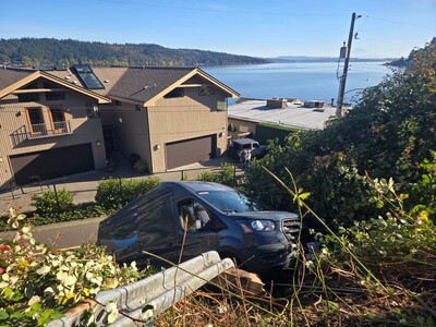
According to the City’s mapping data and geotechnical report, the
location of the single-family home is within a steep slope, landslide,
and stream areas as defined in LFPMC 16.16.040.


Overcast, with a high of 59 and low of 43 degrees. Mist during the morning, overcast in the afternoon, cloudy for the evening, overcast overnight.


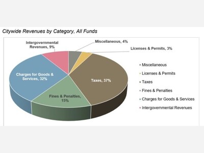

This is really well done and should be read by everyone who will vote on the property tax levy lid increase in our upcoming election. I hope every LFP council member has already read it and understands it.
I'm impressed with the analysis but I didn't see any attribution so am curious to know whether this was written by a human or generated by AI.
Both.